![](/images/other/stat-length.png)
![Trail On foot Rychnov nad Kněžnou - PPP Stezka - Photo](https://media.geolcdn.com/t/1900/400/3b8acea2-8e53-464b-9838-a97d5e19febe.jpeg&format=pjpeg&maxdim=2)
PPP Stezka
SityTrail - itinéraires balisés pédestres
Tous les sentiers balisés d’Europe GUIDE+
![Length](/images/other/stat-length.png)
Length
4.3 km
![Max alt](https://static1.geolcdn.com/siteimages/upload/files/1508320355ic_sort_altitude_max_24dp.png)
Max alt
411 m
![Uphill gradient](https://static1.geolcdn.com/siteimages/upload/files/1508320355ic_sort_den_pos_24dp.png)
Uphill gradient
103 m
![Km-Effort](/images/other/stat-length.png)
Km-Effort
5.4 km
![Min alt](https://static1.geolcdn.com/siteimages/upload/files/1508320355ic_sort_altitude_min_24dp.png)
Min alt
317 m
![Downhill gradient](https://static1.geolcdn.com/siteimages/upload/files/1508320355ic_sort_den_neg_24dp.png)
Downhill gradient
15 m
![Boucle](https://static1.geolcdn.com/siteimages/upload/files/16400158638029165_repeat_loop_refresh_sync_direction_icon.png)
Boucle
No
Signpost
Creation date :
2025-02-07 10:17:56.308
Updated on :
2025-02-07 10:17:56.308
![On foot](https://static1.geolcdn.com/sitytour/trail-icons/100.png)
1h13
Difficulty : Easy
![Scan this QR Code to open this trail in the SityTrail application](https://capi.geolives.com/qq0zvz2zws4bq2lad0pu/sitytour/trails/4345208/qr.png?size=200)
FREE GPS app for hiking
About
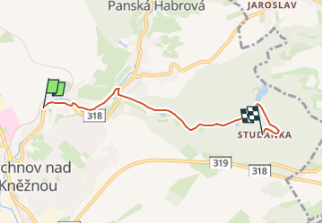
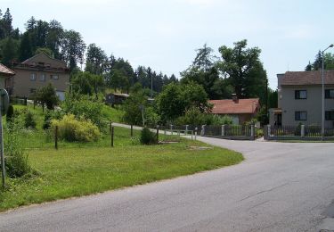
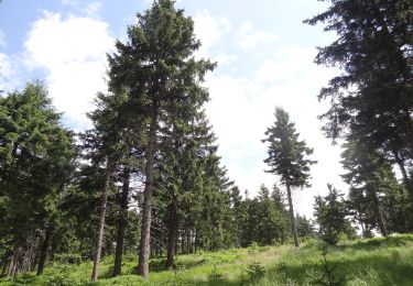
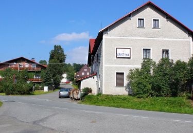
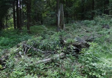
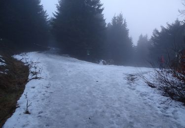
Trail On foot of 4.3 km to be discovered at Northeast, Královéhradecký kraj, Rychnov nad Kněžnou. This trail is proposed by SityTrail - itinéraires balisés pédestres.
Description
Trail created by cz:KČT.
zelená: Rychnov n. K. - Červená Voda
Positioning
Country:
Czech Republic
Region :
Northeast
Department/Province :
Královéhradecký kraj
Municipality :
Rychnov nad Kněžnou
Location:
Unknown
Start:(Dec)
Start:(UTM)
591270 ; 5558479 (33U) N.
Comments
Trails nearby
![Trail On foot Veliny - Naučná stezka rytíře Velingera - Photo](https://media.geolcdn.com/t/375/260/b2a4504b-4d31-41bf-ab67-463221cb32b7.jpeg&format=jpg&maxdim=2)
![On foot On foot](https://static1.geolcdn.com/sitytour/trail-icons/100.png)
Naučná stezka rytíře Velingera
On foot
Easy
Veliny,
Northeast,
Pardubický kraj,
Czech Republic
![](/images/other/stat-length.png)
4.5 km | 5.3 km-effort
1h 12min
![](https://static1.geolcdn.com/siteimages/upload/files/16400158638029165_repeat_loop_refresh_sync_direction_icon.png)
No
![Trail On foot Záchlumí - [M] Litice nad Orlicí - Žamberk - Photo](https://media.geolcdn.com/t/375/260/06e32d5b-ad68-47cd-bbfd-bb17859dd844.jpeg&format=jpg&maxdim=2)
![On foot On foot](https://static1.geolcdn.com/sitytour/trail-icons/100.png)
[M] Litice nad Orlicí - Žamberk
On foot
Easy
Záchlumí,
Northeast,
Pardubický kraj,
Czech Republic
![](/images/other/stat-length.png)
9.6 km | 12.1 km-effort
2h 45min
![](https://static1.geolcdn.com/siteimages/upload/files/16400158638029165_repeat_loop_refresh_sync_direction_icon.png)
No
![Trail On foot Opočno - Semechnický okruh - Photo](https://media.geolcdn.com/t/375/260/0de50771-fa51-4017-81ff-83c624e77321.jpeg&format=jpg&maxdim=2)
![On foot On foot](https://static1.geolcdn.com/sitytour/trail-icons/100.png)
Semechnický okruh
On foot
Easy
Opočno,
Northeast,
Královéhradecký kraj,
Czech Republic
![](/images/other/stat-length.png)
13.1 km | 15.6 km-effort
3h 32min
![](https://static1.geolcdn.com/siteimages/upload/files/16400158638029165_repeat_loop_refresh_sync_direction_icon.png)
Yes
![Trail On foot Choceň - NS Dívčí doly - Photo](https://media.geolcdn.com/t/375/260/0bcec713-5f83-4b6a-aab0-8a056fd60769.jpeg&format=jpg&maxdim=2)
![On foot On foot](https://static1.geolcdn.com/sitytour/trail-icons/100.png)
NS Dívčí doly
On foot
Easy
Choceň,
Northeast,
Pardubický kraj,
Czech Republic
![](/images/other/stat-length.png)
3.9 km | 5 km-effort
1h 8min
![](https://static1.geolcdn.com/siteimages/upload/files/16400158638029165_repeat_loop_refresh_sync_direction_icon.png)
Yes
![Trail On foot Deštné v Orlických horách - NS Okolím Deštného - Photo](https://media.geolcdn.com/t/375/260/0176fee2-7329-40d4-91f0-e2dbb8b4ce79.jpeg&format=jpg&maxdim=2)
![On foot On foot](https://static1.geolcdn.com/sitytour/trail-icons/100.png)
NS Okolím Deštného
On foot
Medium
Deštné v Orlických horách,
Northeast,
Královéhradecký kraj,
Czech Republic
![](/images/other/stat-length.png)
17.4 km | 26 km-effort
5h 49min
![](https://static1.geolcdn.com/siteimages/upload/files/16400158638029165_repeat_loop_refresh_sync_direction_icon.png)
No
![Trail On foot Deštné v Orlických horách - NS Deštné v Orlických horách - Photo](https://media.geolcdn.com/t/375/260/2477e2fe-8d15-48c3-a66c-070bb59c3de9.jpeg&format=jpg&maxdim=2)
![On foot On foot](https://static1.geolcdn.com/sitytour/trail-icons/100.png)
NS Deštné v Orlických horách
On foot
Easy
Deštné v Orlických horách,
Northeast,
Královéhradecký kraj,
Czech Republic
![](/images/other/stat-length.png)
6.5 km | 9.8 km-effort
2h 13min
![](https://static1.geolcdn.com/siteimages/upload/files/16400158638029165_repeat_loop_refresh_sync_direction_icon.png)
Yes
![Trail On foot Deštné v Orlických horách - CZ-NS Po hřebeni Orlických hor - Photo](https://media.geolcdn.com/t/375/260/abb98e6b-4459-4346-bb7f-ccad3f8afe80.jpeg&format=jpg&maxdim=2)
![On foot On foot](https://static1.geolcdn.com/sitytour/trail-icons/100.png)
CZ-NS Po hřebeni Orlických hor
On foot
Easy
Deštné v Orlických horách,
Northeast,
Královéhradecký kraj,
Czech Republic
![](/images/other/stat-length.png)
14.8 km | 19.4 km-effort
4h 24min
![](https://static1.geolcdn.com/siteimages/upload/files/16400158638029165_repeat_loop_refresh_sync_direction_icon.png)
No
![Trail On foot Rokytnice v Orlických horách - NS Opevnění Rokytnicka - Photo](https://media.geolcdn.com/t/375/260/a0c96dca-eb28-4f93-abc6-4ce39ab56662.jpeg&format=jpg&maxdim=2)
![On foot On foot](https://static1.geolcdn.com/sitytour/trail-icons/100.png)
NS Opevnění Rokytnicka
On foot
Easy
Rokytnice v Orlických horách,
Northeast,
Královéhradecký kraj,
Czech Republic
![](/images/other/stat-length.png)
4.5 km | 6.9 km-effort
1h 34min
![](https://static1.geolcdn.com/siteimages/upload/files/16400158638029165_repeat_loop_refresh_sync_direction_icon.png)
No
![Trail On foot Žamberk - Výletní okruh městem - Photo](https://media.geolcdn.com/t/375/260/6acd1579-fe43-4d48-b6dd-b843c1fe193b.jpeg&format=jpg&maxdim=2)
![On foot On foot](https://static1.geolcdn.com/sitytour/trail-icons/100.png)
Výletní okruh městem
On foot
Easy
Žamberk,
Northeast,
Pardubický kraj,
Czech Republic
![](/images/other/stat-length.png)
8.9 km | 10.6 km-effort
2h 24min
![](https://static1.geolcdn.com/siteimages/upload/files/16400158638029165_repeat_loop_refresh_sync_direction_icon.png)
Yes